Curriculum & Activities
Sanctuary Web Quest Digital Scavenger Hunt Activity
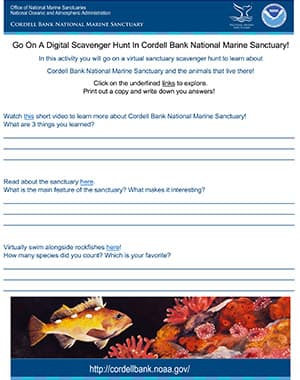
In this activity, students can click on the links provided in the PDF to learn about what makes Cordell Bank National Marine Sanctuary so unique. Watch videos, look at images and read about this unique offshore national marine sanctuary and either fill in digitally or print and fill in the answers.
Grades 4-8
Cordell Bank web quest scavenger hunt
Seabird web quest scavenger hunt
Winged Ambassadors:
Ocean Literacy through the Eyes of Albatross
Albatrosses, charismatic and threatened seabirds, are ambassadors for a clean ocean. They traverse vast oceanic regions searching for floating food. Along their journeys, they ingest plastic trash and are hooked in fisheries. These five lessons use inquiry-based science instruction, aligned to standards for grades 6 – 8 with extensions for grades 9 – 12.
Lesson 1 – Introduction to Seabirds
Lesson 2 – Tracking Albatross Migrations
Lesson 3 – Protecting Ocean Hotspots
Lesson 4 – Bolus Analysis
Lesson 5 – Campus Debris Survey
Students will:
- Use real data from current research tracking albatross migrations and ocean plastic pollution
- Be inspired by paintings and photographs from scientist and artist Sophie Webb
- Investigate albatross diets using detailed images of dissected boluses by National Geographic photographer David Liittschwager
- Lesson plan with learning objectives and procedures, an outline of necessary materials and preparation, time estimates, suggested discussion questions and possible answers, ideas for differentiating activities for diverse learners, and expanded resources, videos and links
- Student Worksheets and Handouts for photocopying and/or projecting
- Presentations with photos, art, wildlife research data, and teacher presentation notes to support the lesson
Download the activity package for free at www.downloadwingedambassadors.org.
This activity package was produced by Oikonos - Ecosystem Knowledge and Meghan Marerro in collaboration with Cordell Bank National Marine Sanctuary and the Papahānaumokuākea Marine National Monument with funding from NOAA's Office of National Marine Sanctuaries, Pacific Islands region, and West Coast region.
Dungeness Crab Case Study: Communication Toolkit

The Dungeness Crab Tool Kit provides various outreach and education tools to teach about how ocean acidification could negatively impact dungeness crab. Dungeness crab is a valuable species throughout the national marine sanctuaries of the West Coast from Washington state to throughout California. This communication toolkit is designed for educators and communicators to use to teach others about the impact of ocean acidification on Dungeness crab.
The toolkit includes: fact sheet; infographic; PowerPoint slideshow with script; reference list; resource list; public domain video B-roll; and public domain images.
How Increased Ocean Noise Affects Whales
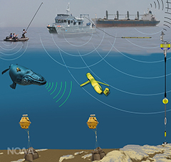
Ocean noise is on the rise, and NOAA and National Marine Sanctuaries are working to measure it. This activity introduces how ocean noise affects whales, how sound travels in waves, and how increasing noise is interrupting whale communication. Includes links to videos, instructional sequence, introduction to sanctuary monitoring effort and reflection activities. For Grades 3-5, NGSS, and ocean literacy aligned.
Ocean Acidification Calcifier Sort Activity
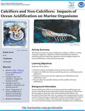
Students learn about what is causing ocean acidification and explore organisms that are directly affected by ocean acidification.
Deep Coral Communities Curriculum
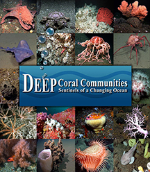
Deep Coral Communities Sentinels of a Changing Ocean CurriculumTake your students on an incredible journey hundreds of feet beneath the surface of the ocean without ever leaving the classroom! Using research footage from remotely operated vehicles, your students will be able to utilize real scientific methods to explore the unique deep-sea coral communities found in our West Coast national marine sanctuaries (including Cordell Bank NMS). These materials are aligned with the Next Generation Scinece Standards, Common Core Education Standards and Ocean and Climate Literacy standards. Available free to download from the National Marine Sanctuaries Education web page.
Teacher at Sea Activity: What Influences a Marine Food Web
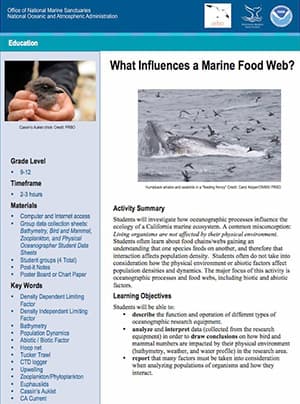
With the use of videos and looking at real data, Students will investigate how oceanographic processes influence the ecology of a California marine ecosystem.
Teaching Materials:
Download the Activity (708kb pdf)
Pre/Post text (96kb pdf)
Supporting Student Data Pages:
Bathmetry Student Data Sheet (92kb pdf)
Bird and Mammal Student Data Sheet (91kb pdf)
Zooplankton Student Data Sheet (107kb pdf)
Physical Oceanography Student Data Sheet (545kb pdf)
Videos to go with this activity are in the Cordell Bank National Marine Sanctuary Video Library
Seafloor Habitat Comparison Activity "Every Square Inch Counts"
Activity: Every Square Inch Counts: In this activity students compare rocky intertidal and underwater “subtidal” habitats through the use of photos and quadrats and using compare/contrast methods.
Activity outline: Every Square Inch Counts (28KB PDF)
Intertidal ID Cards (480KB PDF)
Rocky Intertidal Data Sheet and Answers (36KB PDF)
Intertidal Photo Quadrat 1 (216KB JPG)
Intertidal Photo Quadrat 2 (380KB JPG)
Intertidal Photo Quadrat 3 (368KB JPG)
Intertidal Photo Quadrat 4 (316KB JPG)
Intertidal Photo Quadrat 5 (368KB JPG)
Intertidal Photo Quadrat 6 (332KB JPG)
Subtidal ID Cards (3.5MB PDF)
Subtidal photo data sheet/answer guide (68KB PDF)
Subtidal photo A 8.5x14in (1.5MB PDF)
Subtidal photo B 8.5x14in (1.1MB PDF)
Subtidal photo C 8.5x14in (1.1MB PDF)
Subtidal photo D 8.5x14in (676KB PDF)
Introductory Slideshow in PDF format (10.6 MB PDF)
Introductory Slide Show Script (676KB PDF)
To get the powerpoint version of the introductory presentation, contact jennifer.stock@noaa.gov.
Explore a Story Map
What is a bank? Why is this geologic feature so important?
Click on this "StoryMap" to discover the bank sanctuaries. The Earth has one big ocean with many features (Ocean Literacy principle #1) . Scroll through to discover the national marine sanctuaries that feature bank habitats and discover what makes them so unique and special.

