Cordell Bank & Gulf of the (now "Greater") Farallones National Marine Sanctuaries Expanded
Sanctuaries' Expanded Boundaries and Revised Regulations Effective June 2015
NOAA has expanded the boundaries of Cordell Bank and Gulf of the Farallones national marine sanctuaries (CBNMS and GFNMS) to an area north and west of their previous boundaries; the final rule rule published in the Federal Register on March 12, 2015. As part of this action, NOAA revised the terms of designation, management plans, and regulations for these two sanctuaries. The regulations became effective June 9, 2015. The notice of the effective date of the regulations was printed in the Federal Register on June 15, 2015. The notice also announced that effective June 15, 2015, NOAA changed the name of Gulf of the Farallones National Marine Sanctuary to "Greater Farallones National Marine Sanctuary" and made some corresponding technical corrections to the regulations.
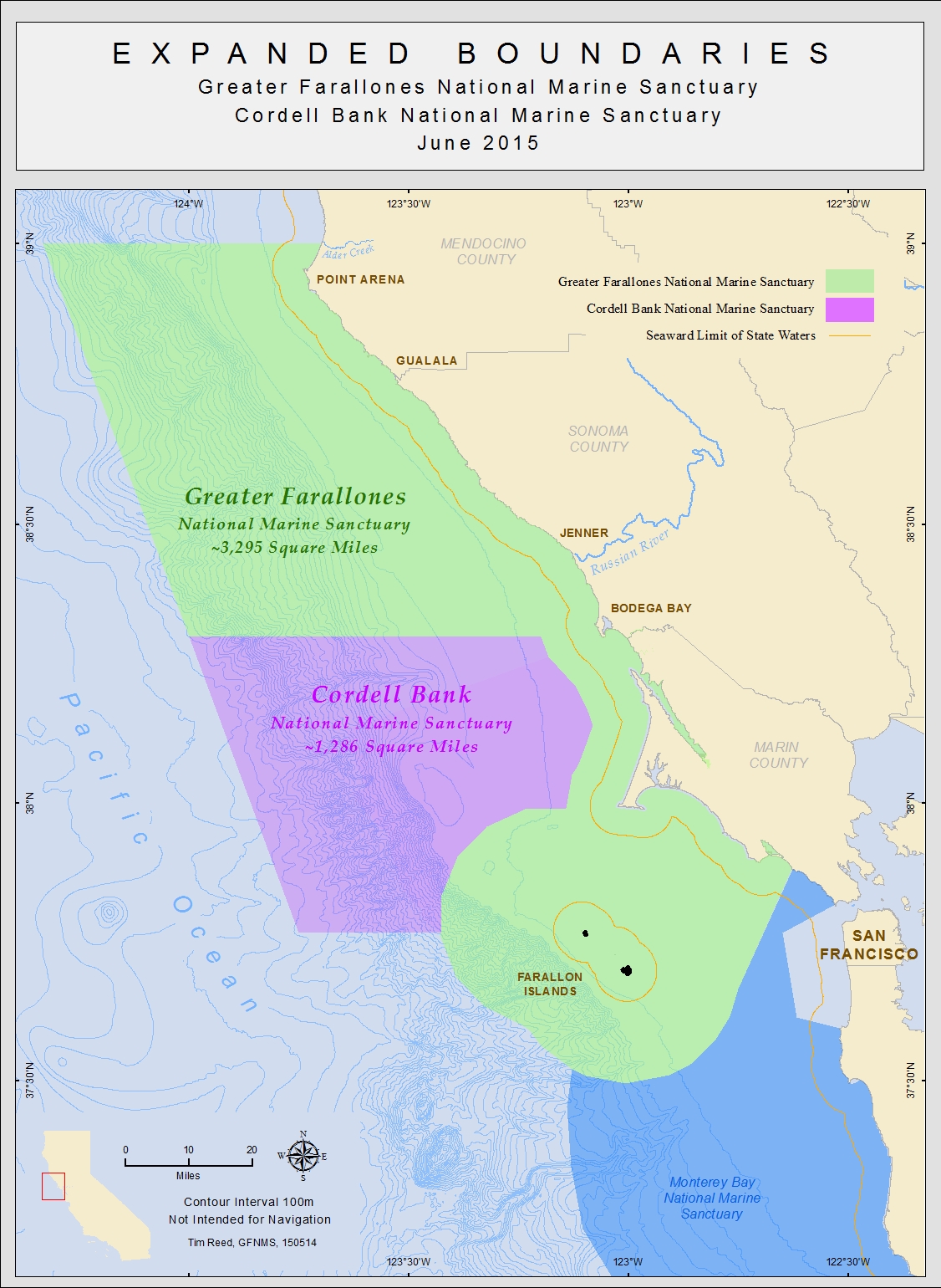
The expansion area extends along the coastline from Sonoma County's Bodega Bay to the 39th latitude, a few miles north of the Point Arena Lighthouse in Mendocino County. This area encompasses one of North America's most productive upwelling zones originating off of Point Arena. The nutrients brought to the surface during upwelling events at Point Arena are carried south by the prevailing wind driven surface currents. These nutrients fuel an incredibly productive ocean area protected by GFNMS and CBNMS.
To get more information about this action, including copies of the final environmental impact statement (FEIS), final management plans, and the final rule, visit
this link.